Skip to main content
UTA Libraries
Digital Gallery
Browse
All Items
Categories
Collections
About
About
Acknowledgements
Contact Us
Sort by
Relevance
Relevance
Items per page
48
60
72
120
Clear
Search
Browse
All Items
Categories
Collections
About
Home
1750s
Category: Cartography - Maps and Atlases
Category: Cartography - Maps and Atlases
1-8 of 8 results found
(-)
Remove 1750s Coverage filter
1750s Coverage
Sort by
Year Asc
Year Asc
Year Desc
Per page:
48
60
72
120
Apply
Carte Generale des Partes de l'Europe, dans laquelle on a touve toutes les Routes, et marque toutes les Places ou la Poste est etablie
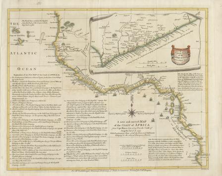
A New and Correct Map of the Coast of Africa from Cape Blance to the Coast of Angola with Explanatory Notes of all the Forts and settlements belonging to the several European Powers
Maritime map of the Gulf of Mexico and surrounding islands by cartographer Thomas Lopez, 1755 (part 1)
Maritime map of the Gulf of Mexico and surrounding islands by cartographer Thomas Lopez, 1755 (part 2)
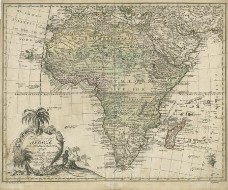
Africae ad Emendatiora Qua Ad Huc Prodierunt Exempla Jussu
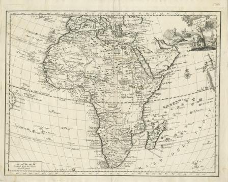
Carta Generale del'Africa
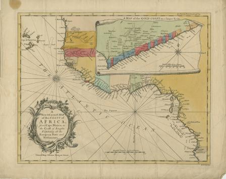
A New and Correct Map of the Coast of Africa from Cape Blanco to the Coast of Angola: Exhibiting all the European Forts and Settlements
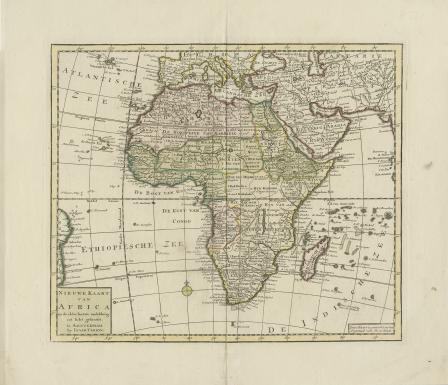
Nieuwe Kaart van Africa