GeoCoords:
Latitude: 28.673366000000
Longitude: -97.405757000000
Longitude: -97.405757000000
County:
- Goliad
Date:
May 1832
Time Period:
Description:
Comanches kill a party of woodcutters and capture a young boy near Goliad.
Event Type:
Race or Ethnicity:
Tribe:
Age:
child (0-12)
Citation:
F. Todd Smith, From Dominance to Disappearance: The Indians of Texas and the Near Southwest, 1786-1859 (Lincoln: University of Nebraska Press, 2005), 142
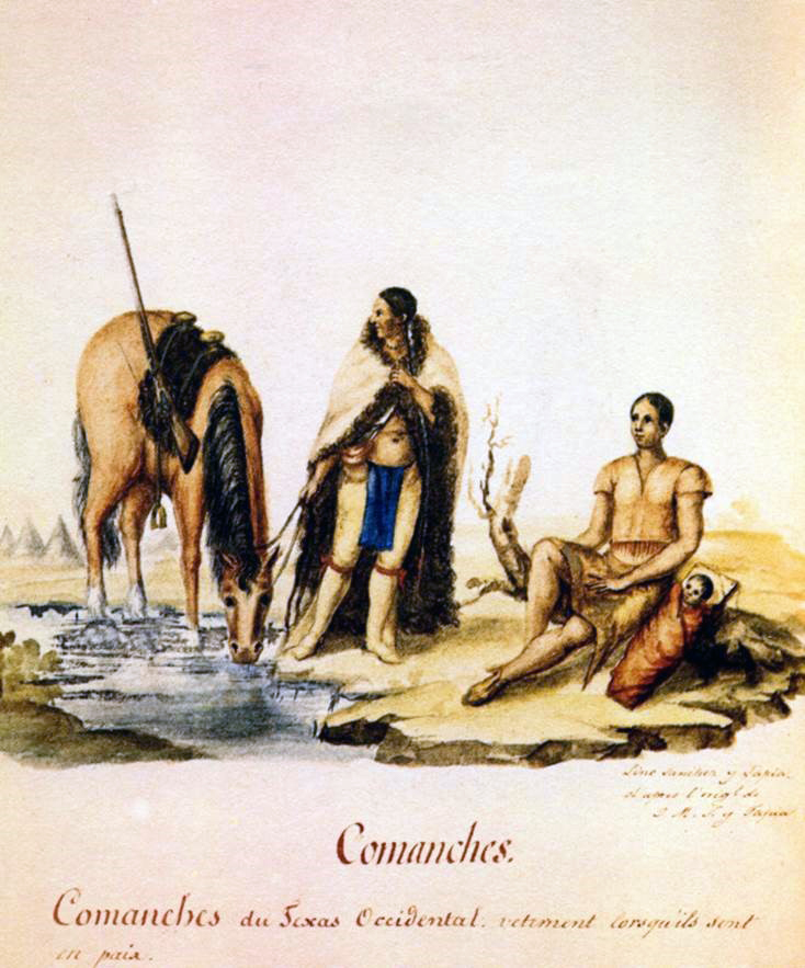 Comanche Indians
 Original Title: Comanches. Comanches du Texas Occidentauetement lorsqúils son ten paix
Image Type: Watercolor and ink on paper
Creator: Lino Sánchez y Tapia after José María Sánchez y Tapia
Collection: Thomas W. Gilcrease Museum, Tulsa, Oklahoma
Image Citation:
Berlandier, Jean Louis, The Indians of Texas in 1830. Washington, D.C.: Smithsonian Press, 1969, Plate 2
GeoCoords:
Latitude: 28.673366000000
Longitude: -97.405757000000
Longitude: -97.405757000000
County:
- Goliad
Date:
May 1832
Event Description:
Comanches kill a party of woodcutters and capture a young boy near Goliad.
Event Type:
Tribe:
- Comanches
Gender:
male
Age:
child (0-12)
Citation:
F. Todd Smith, From Dominance to Disappearance: The Indians of Texas and the Near Southwest, 1786-1859 (Lincoln: University of Nebraska Press, 2005), 142
Comanche Indians Original Title: Comanches. Comanches du Texas Occidentauetement lorsqúils son ten paix
Image Type: Watercolor and ink on paper
Creator: Lino Sánchez y Tapia after José María Sánchez y Tapia
Collection: Thomas W. Gilcrease Museum, Tulsa, Oklahoma
Image Citation:
Berlandier, Jean Louis, The Indians of Texas in 1830. Washington, D.C.: Smithsonian Press, 1969, Plate 2