GeoCoords:
Latitude: 28.655410000000
Longitude: -96.963357000000
Longitude: -96.963357000000
County:
- Victoria
Date:
November 1844
Time Period:
Description:
Capt. John F. Kemper is killed by Karankawas at his home on Kemper’s Bluff, a trading post on the Guadalupe River.
Event Type:
Race or Ethnicity:
Tribe:
Age:
adult (18+)
Citation:
Hobart Huson, Refugio: A Comprehensive History of Refugio County from Aboriginal Times to 1953 (Rooke Foundation, 1953), 1:44.
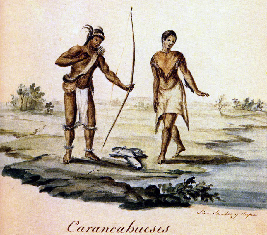 Karankawa Indians
 Original Title: Carancahueses
Image Type: Watercolor and ink on paper
Creator: Lino Sánchez y Tapia
Collection: Thomas W. Gilcrease Museum, Tulsa, Oklahoma
Image Citation:
Jean Louis Berlandier, The Indians of Texas in 1830. Washington, D.C.: Smithsonian Press, 1969, Plate 15
GeoCoords:
Latitude: 28.655410000000
Longitude: -96.963357000000
Longitude: -96.963357000000
County:
- Victoria
Date:
November 1844
Event Description:
Capt. John F. Kemper is killed by Karankawas at his home on Kemper’s Bluff, a trading post on the Guadalupe River.
Event Type:
Tribe:
- Karankawas
Age:
adult (18+)
Citation:
Hobart Huson, Refugio: A Comprehensive History of Refugio County from Aboriginal Times to 1953 (Rooke Foundation, 1953), 1:44.
Karankawa Indians Original Title: Carancahueses
Image Type: Watercolor and ink on paper
Creator: Lino Sánchez y Tapia
Collection: Thomas W. Gilcrease Museum, Tulsa, Oklahoma
Image Citation:
Jean Louis Berlandier, The Indians of Texas in 1830. Washington, D.C.: Smithsonian Press, 1969, Plate 15