GeoCoords:
Latitude: 31.017530000000
Longitude: -97.403646000000
Longitude: -97.403646000000
County:
- Bell
Date:
July 19, 1843
Time Period:
Description:
A band of Wichitas attempts to steal horses of Lipan Apaches encamped on the Leon River, above Little River Fort. One Wichita (Toweash) is killed, one Wichita (Kaichai) is taken prisoner.
Event Type:
Race or Ethnicity:
Age:
adult (18+)
Citation:
Clarksville Northern Standard, June 22, 1843
Lorna Geer Sheppard, ed., An Editor’s View of Early Texas (Austin: Eakin Press, 1998), 54.
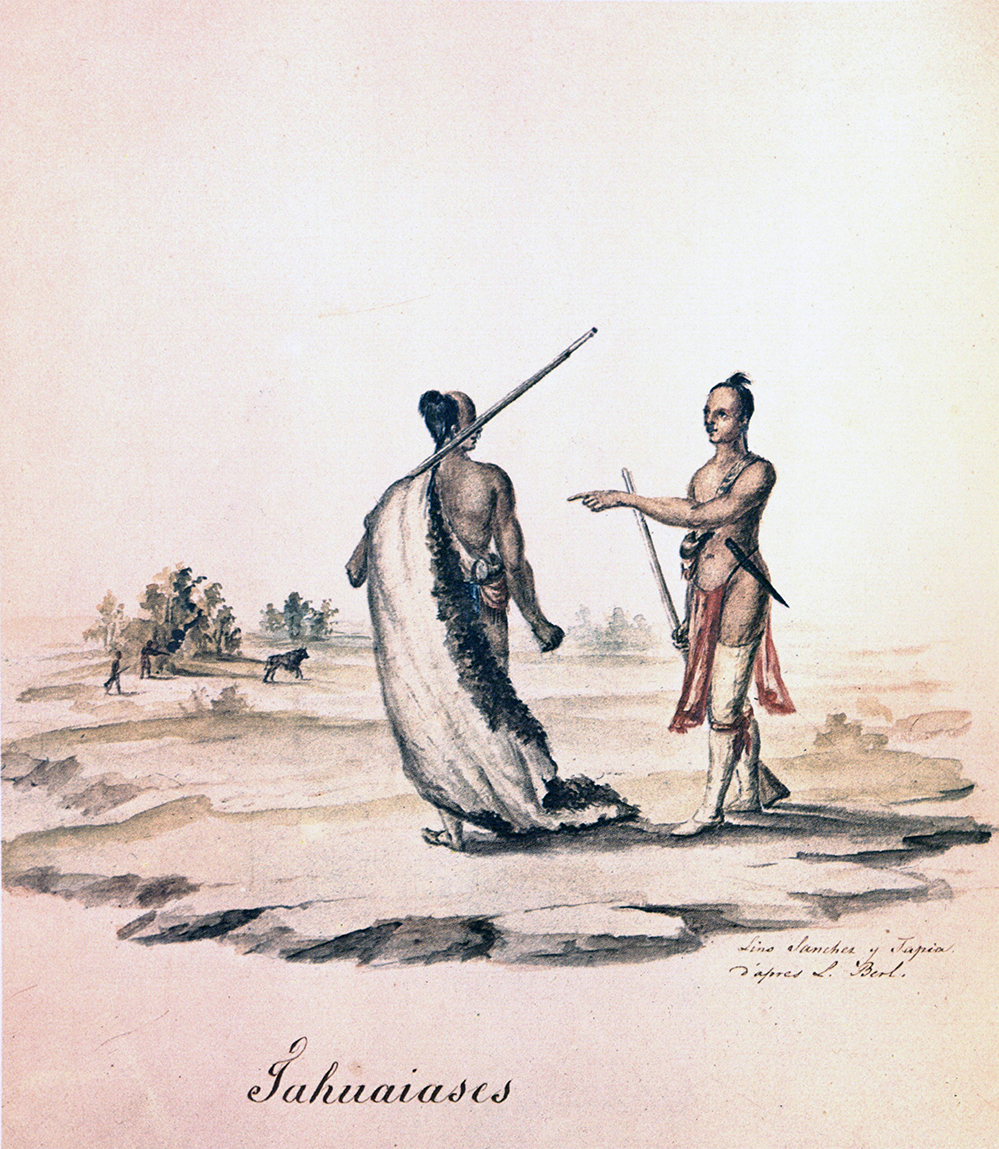 Toweash Indian
 Original Title: Tahuaiases
Image Type: Watercolor and ink on paper
Creator: Lino Sanchez y Tapia after Jean Louis Berlandier
Collection: Thomas W. Gilcrease Museum, Tulsa, Oklahoma
Image Citation:
Jean Louis Berlandier, The Indians of Texas in 1830. Washington, D.C.: Smithsonian Press, 1969, Plate 14
GeoCoords:
Latitude: 31.017530000000
Longitude: -97.403646000000
Longitude: -97.403646000000
County:
- Bell
Date:
July 19, 1843
Event Description:
A band of Wichitas attempts to steal horses of Lipan Apaches encamped on the Leon River, above Little River Fort. One Wichita (Toweash) is killed, one Wichita (Kaichai) is taken prisoner.
Event Type:
Tribe:
- Wichitas
- Toweash
- Wichitas
- Kichais
- Apaches
- Lipans
Age:
adult (18+)
Citation:
Clarksville Northern Standard, June 22, 1843
Lorna Geer Sheppard, ed., An Editor’s View of Early Texas (Austin: Eakin Press, 1998), 54.
Toweash Indian Original Title: Tahuaiases
Image Type: Watercolor and ink on paper
Creator: Lino Sanchez y Tapia after Jean Louis Berlandier
Collection: Thomas W. Gilcrease Museum, Tulsa, Oklahoma
Image Citation:
Jean Louis Berlandier, The Indians of Texas in 1830. Washington, D.C.: Smithsonian Press, 1969, Plate 14