
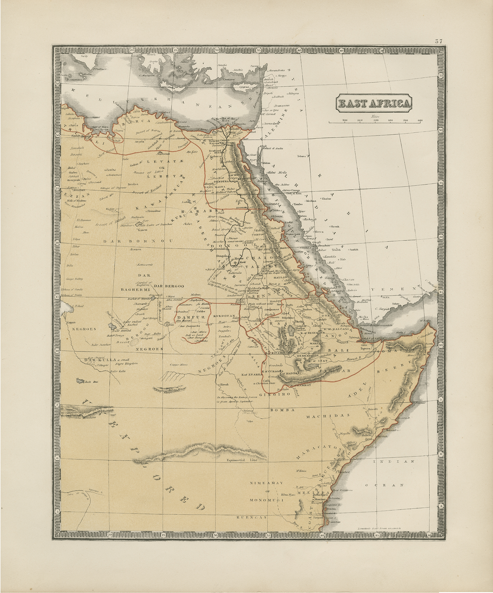
Detailed map of Africa extending from the mouth of the Nile to Zanzibar. McPhun provides information over weather and climate patterns.
Single-page, single-sided map. 34.5 cm. x 28 cm. [Gift of Dr. Jack Franke]
Item: East Africa
APA
Maps of Africa, University of Texas at Arlington Libraries. East Africa. (1863). Retrieved from https://library.uta.edu/digitalgallery/img/20086371Chicago/Turabian
Maps of Africa, University of Texas at Arlington Libraries. "East Africa." UTA Libraries Digital Gallery. 1863. AccessedApril 28, 2024
MLA
Maps of Africa, University of Texas at Arlington Libraries. East Africa. 1863. UTA Libraries Digital Gallery, https://library.uta.edu/digitalgallery/img/20086371. Accessed28 Apr 2024
Special Collections Reference Information
Original image part of the Maps of Africa, University of Texas at Arlington Libraries. Identifier: 2019-392, McPhun_East Africa_1863_UTA_2019-392
Identifier: 20086371
Title: East Africa
Creator: McPhun, William (Cartographer)
Description: Detailed map of Africa extending from the mouth of the Nile to Zanzibar. McPhun provides information over weather and climate patterns. Single-page, single-sided map. 34.5 cm. x 28 cm. [Gift of Dr. Jack Franke]
Date Created: 1863
Coverage: 1860s
Category: Cartography - Maps and Atlases
Subject Term: Maps
Location: East Africa
Collection: Maps of Africa
Language: English
Type: Still Image
Format: JPG
Publisher: University of Texas at Arlington Libraries
Rights Holder: University of Texas at Arlington Libraries, Special Collections
Rights:
License:
Title: East Africa
Creator: McPhun, William (Cartographer)
Description: Detailed map of Africa extending from the mouth of the Nile to Zanzibar. McPhun provides information over weather and climate patterns. Single-page, single-sided map. 34.5 cm. x 28 cm. [Gift of Dr. Jack Franke]
Date Created: 1863
Coverage: 1860s
Category: Cartography - Maps and Atlases
Subject Term: Maps
Location: East Africa
Collection: Maps of Africa
Language: English
Type: Still Image
Format: JPG
Publisher: University of Texas at Arlington Libraries
Rights Holder: University of Texas at Arlington Libraries, Special Collections
Rights:
Any use of content downloaded or printed from this site is limited to non-commercial personal or educational use, including fair use as directed by U.S. copyright laws. For more information or for reproduction requests, please contact Special Collections at The University of Texas at Arlington Libraries by emailing spcoref@uta.edu.
License:
Attribution-NonCommercial 4.0 International (CC BY-NC 4.0) http://creativecommons.org/licenses/by-nc/4.0/ If used, please attribute using one of the citations provided.
Harmful Content Statement: This item includes content that may have outdated language or may be graphic or disturbing in nature. Please refer to our Statement of Harmful Language for more information.