

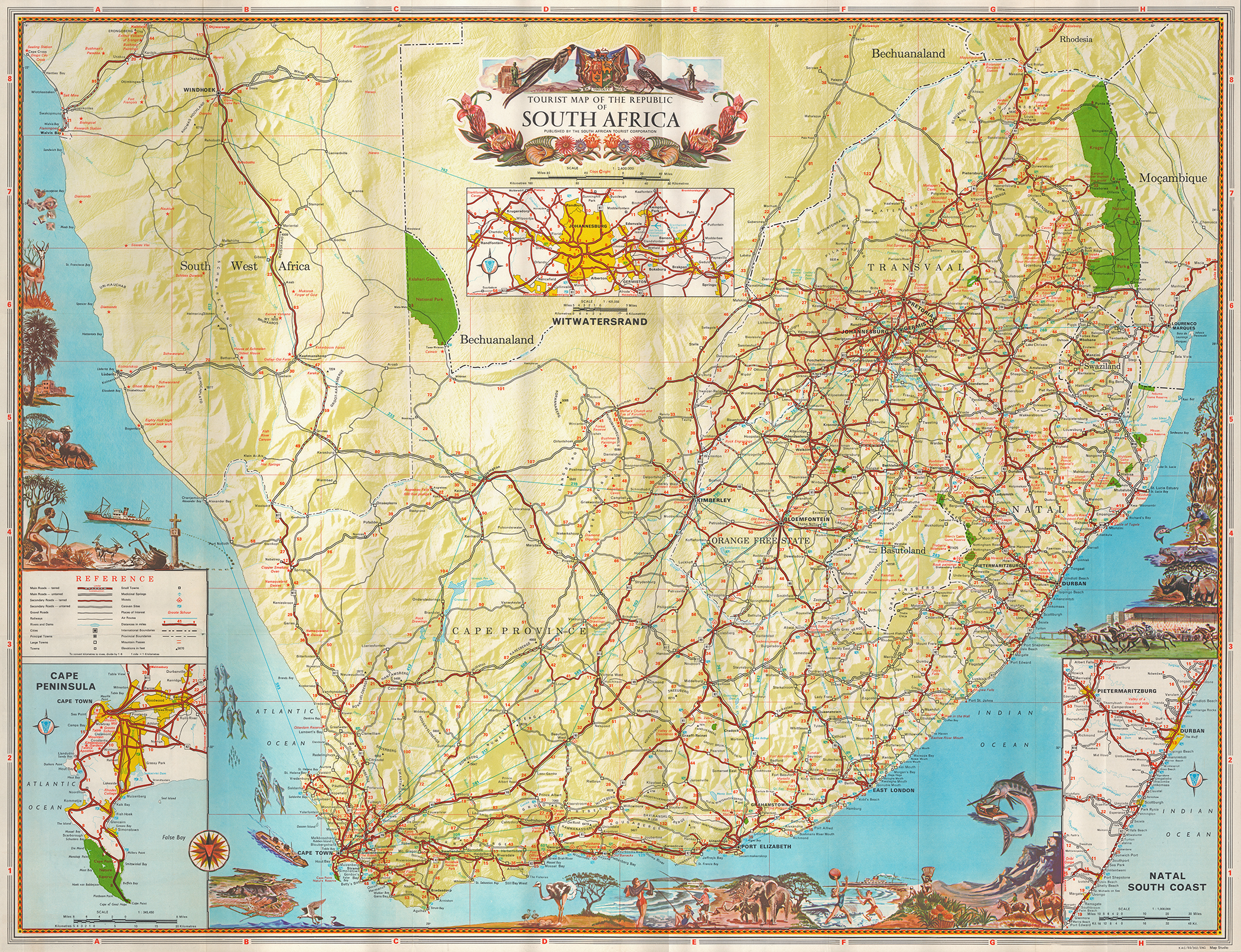
Tourist Map of the Republic of South Africa, ca. 1960s, during Apartheid; published by Map Studio and the South African Tourist Corporation. [Gift of Dr. Jack Franke]
Item: Tourist Map of the Republic of South Africa
APA
Maps of Africa, University of Texas at Arlington Libraries. Tourist Map of the Republic of South Africa. (1960). Retrieved from https://library.uta.edu/digitalgallery/img/20160863Chicago/Turabian
Maps of Africa, University of Texas at Arlington Libraries. "Tourist Map of the Republic of South Africa." UTA Libraries Digital Gallery. 1960. AccessedApril 29, 2024
MLA
Maps of Africa, University of Texas at Arlington Libraries. Tourist Map of the Republic of South Africa. 1960. UTA Libraries Digital Gallery, https://library.uta.edu/digitalgallery/img/20160863. Accessed29 Apr 2024
Special Collections Reference Information
Original image part of the Maps of Africa, University of Texas at Arlington Libraries. Identifier: 2023-490APA
Maps of Africa, University of Texas at Arlington Libraries. Tourist Map of the Republic of South Africa. (1960). Retrieved from https://library.uta.edu/digitalgallery/img/20160863Chicago/Turabian
Maps of Africa, University of Texas at Arlington Libraries. "Tourist Map of the Republic of South Africa." UTA Libraries Digital Gallery. 1960. AccessedApril 29, 2024
MLA
Maps of Africa, University of Texas at Arlington Libraries. Tourist Map of the Republic of South Africa. 1960. UTA Libraries Digital Gallery, https://library.uta.edu/digitalgallery/img/20160863. Accessed29 Apr 2024
Special Collections Reference Information
Original image part of the Maps of Africa, University of Texas at Arlington Libraries. Identifier: 2023-490
Identifier: 20160863
Title: Tourist Map of the Republic of South Africa
Description: Tourist Map of the Republic of South Africa, ca. 1960s, during Apartheid; published by Map Studio and the South African Tourist Corporation. [Gift of Dr. Jack Franke]
Date Created: 1960-1969 (Approximately)
Coverage: 1960s
Category: Cartography - Maps and Atlases
Subject Term: Maps, Tourism
Location: South Africa
Collection: Maps of Africa
Language: None
Type: Still Image
Format: JPG
Publisher: University of Texas at Arlington Libraries
Rights Holder: University of Texas at Arlington Libraries, Special Collections
Rights:
License:
Title: Tourist Map of the Republic of South Africa
Description: Tourist Map of the Republic of South Africa, ca. 1960s, during Apartheid; published by Map Studio and the South African Tourist Corporation. [Gift of Dr. Jack Franke]
Date Created: 1960-1969 (Approximately)
Coverage: 1960s
Category: Cartography - Maps and Atlases
Subject Term: Maps, Tourism
Location: South Africa
Collection: Maps of Africa
Language: None
Type: Still Image
Format: JPG
Publisher: University of Texas at Arlington Libraries
Rights Holder: University of Texas at Arlington Libraries, Special Collections
Rights:
Any use of content downloaded or printed from this site is limited to non-commercial personal or educational use, including fair use as directed by U.S. copyright laws. For more information or for reproduction requests, please contact Special Collections at The University of Texas at Arlington Libraries by emailing spcoref@uta.edu.
License:
Attribution-NonCommercial 4.0 International (CC BY-NC 4.0) http://creativecommons.org/licenses/by-nc/4.0/ If used, please attribute using one of the citations provided.
Harmful Content Statement: This item includes content that may have outdated language or may be graphic or disturbing in nature. Please refer to our Statement of Harmful Language for more information.