Skip to main content
UTA Libraries
Digital Gallery
Browse
All Items
Categories
Collections
About
About
Acknowledgements
Contact Us
Sort by
Relevance
Relevance
Items per page
48
60
72
120
Clear
Search
Browse
All Items
Categories
Collections
About
Home
1940s
Fort Worth (Tex.)
Category: Cartography - Maps and Atlases
Category: Cartography - Maps and Atlases
1-16 of 16 results found
(-)
Remove 1940s Coverage filter
1940s Coverage
(-)
Remove Fort Worth (Tex.) Location filter
Fort Worth (Tex.) Location
Sort by
Year Asc
Year Asc
Year Desc
Per page:
48
60
72
120
Apply
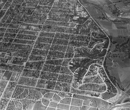
Aerial view of Fort Worth, Texas, Districts - Oakhurst neighborhood
Proposed transatlantic routes for American Airlines
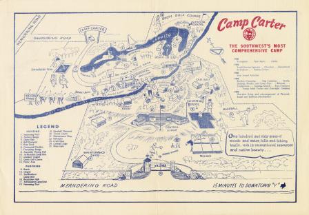
Illustrated map of Camp Carter
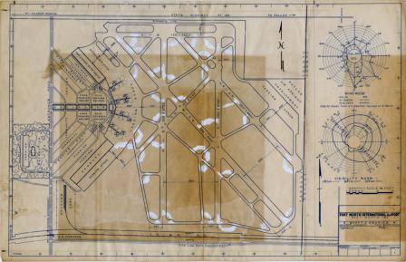
Map: Architect's drawing of Fort Worth International Airport
Mr. and Mrs. Werner Tanner
Fort Worth Army Air Field
Lieutenant Colonel O. H. Osborn
Lavon Peters, geologist for Gulf Oil Corporation
Major General Harvey F. Hazlett and Hallie B. Mallery
United Service Organization Activities
Central Methodist Church mens' Bible class
Texas Christian University Football
Eugenio Newman
Maurice T. Clark
Proposed route to Mexico City for American Airlines
Hockley County Boys visit Livestock Exchange Building