Skip to main content
UTA Libraries
Digital Gallery
Browse
All Items
Categories
Collections
About
About
Acknowledgements
Contact Us
Sort by
Relevance
Relevance
Items per page
48
60
72
120
Clear
Search
Browse
All Items
Categories
Collections
About
Home
Cartography
Category: Cartography - Maps and Atlases
Category: Cartography - Maps and Atlases
1-21 of 21 results found
(-)
Remove Cartography Subject Term filter
Cartography Subject Term
Sort by
Year Asc
Year Asc
Year Desc
Per page:
48
60
72
120
Apply
Proposed transatlantic routes for American Airlines
"You Just Sort of Take Over" Says Marine Officer
Lieutenant Colonel Harold R. Lee
Proposed route to Mexico City for American Airlines
Hand-drawn map of Eagle Flat, W. K. Gordon
Hand-drawn cross-section of Eagle Mountain and valleys on each side, W. K. Gordon, July 17, 1895
Hand-drawn map of the Eagle Flat areas, W. K. Gordon, July 17, 1895
United States Geological Survey topographical map of 1890
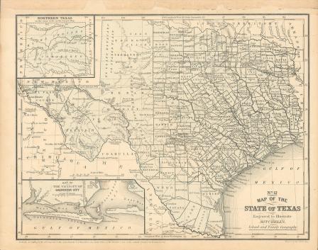
Map of Texas, 1859
Map of Texas, 1858
Map of Texas, 1858 (black and white)
"Karte des Staates Texas"
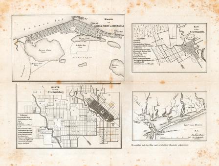
Map of the cities of Indianola, New Braunfels and Fredericksburg, Texas, ca. 1850
Map of the cities of New Braunfels and Fredericksburg
Karte des Staates Texas (aufgenommen in die Union 1846) nach der neuesten Eintheilung 1849
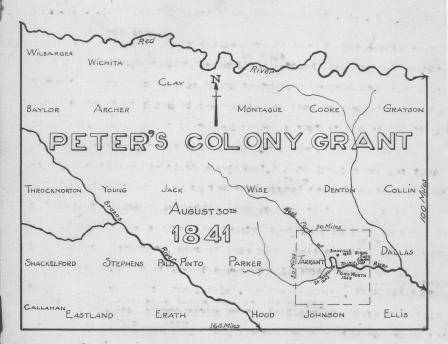
Peter's Colony Grant map, 1841, showing Texas counties
Maritime map of the Gulf of Mexico and surrounding islands by cartographer Thomas Lopez, 1755 (part 2)
"Les Costes aux Environs de la Riviere de Misisipi"
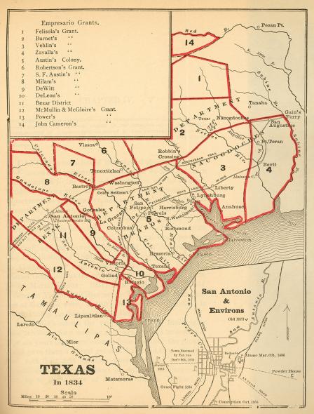
Texas in 1834
Old Surveys in Harrison County
"La Riviere de Missisipi,"