Skip to main content
UTA Libraries
Digital Gallery
Browse
All Items
Categories
Collections
About
About
Acknowledgements
Contact Us
Sort by
Relevance
Relevance
Items per page
48
60
72
120
Clear
Search
Browse
All Items
Categories
Collections
About
Home
Aerial photographs
Category: Cartography - Maps and Atlases
Category: Cartography - Maps and Atlases
1-6 of 6 results found
(-)
Remove Aerial photographs Subject Term filter
Aerial photographs Subject Term
Sort by
Year Asc
Year Asc
Year Desc
Per page:
48
60
72
120
Apply
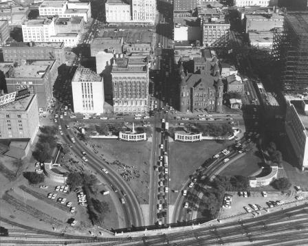
Dealey Plaza and triple underpass, Dallas, Texas
Aerial view of Fort Worth City, 1953
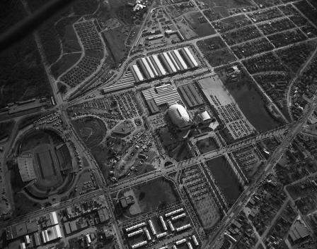
Bell Aircraft Corporation's helicopter factory
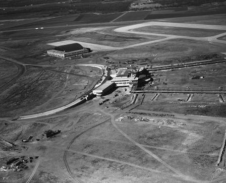
Greater Fort Worth International Airport, air view
Greater Fort Worth International Airport, air view
Aerial view of Fort Worth's Oakhurst subdivision