GeoCoords:
Latitude: 30.095425000000
Longitude: -97.328520000000
Longitude: -97.328520000000
County:
- Bastrop
Date:
September 1, 1840
Time Period:
Description:
Michael Nash, a carpenter, is killed by Indians, probably Comanches, three miles outside of Bastrop.
Event Type:
Race or Ethnicity:
Tribe:
Age:
adult (18+)
Citation:
John Holland Jenkins, Recollections of Early Texas: The Memoirs of John Holland Jenkins (Austin: UT Press), 104.
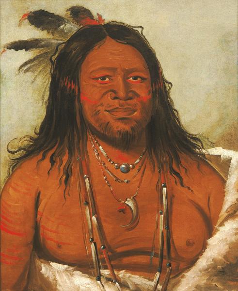 Comanche Indian
 Original Title: Ta-wáh-que-nah, Mountain of Rocks, Second Chief of the Tribe (Comanche)
Image Type: Oil on canvas
Creator: George Catlin, 1834
Collection: Smithsonian American Art Museum, Gift of Mrs. Joseph Harrison, Jr.
Image Viewed: https://americanart.si.edu/artwork/ta-wah-que-nah-mountain-rocks-second-chief-tribe-4278
Image Accessed: April 9, 2019
GeoCoords:
Latitude: 30.095425000000
Longitude: -97.328520000000
Longitude: -97.328520000000
County:
- Bastrop
Date:
September 1, 1840
Event Description:
Michael Nash, a carpenter, is killed by Indians, probably Comanches, three miles outside of Bastrop.
Event Type:
Tribe:
- Comanches
Gender:
male
Age:
adult (18+)
Citation:
John Holland Jenkins, Recollections of Early Texas: The Memoirs of John Holland Jenkins (Austin: UT Press), 104.
Comanche Indian Original Title: Ta-wáh-que-nah, Mountain of Rocks, Second Chief of the Tribe (Comanche)
Image Type: Oil on canvas
Creator: George Catlin, 1834
Collection: Smithsonian American Art Museum, Gift of Mrs. Joseph Harrison, Jr.
Image Viewed: https://americanart.si.edu/artwork/ta-wah-que-nah-mountain-rocks-second-chief-tribe-4278
Image Accessed: April 9, 2019